Emergency maps and dashboards

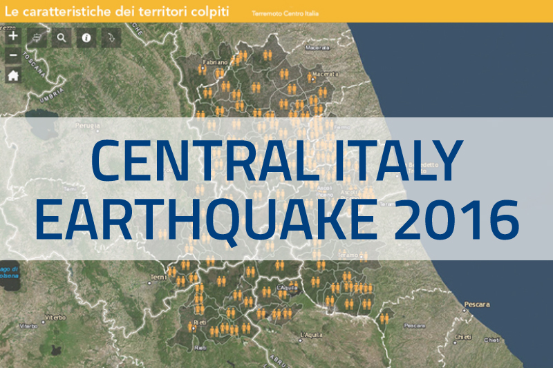
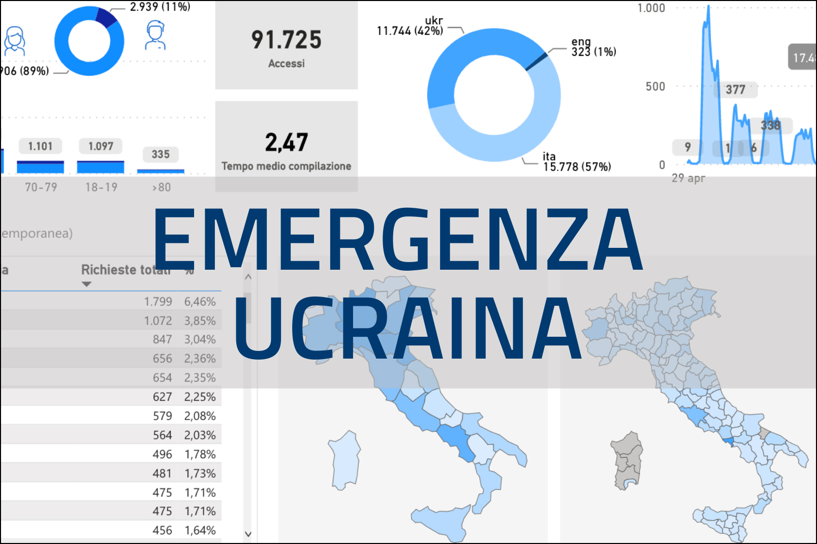
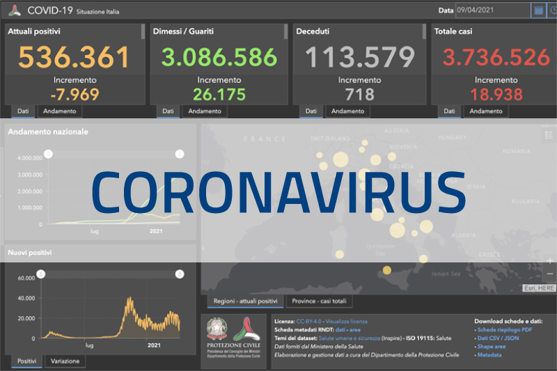
In this section the maps and dashboards related to the most recent emergencies coordinated by the Civil Protection Department can be consulted. For the Niscemi Landslide Emergency 2026, two maps are available: one focusing on the landslide area and the safety zone, and the other illustrating the before-and-after situation of the event. For the Ukraine Emergency, there are several dashboards and a map showing humanitarian aid, allowing users to view detailed information on the supplies delivered, broken down by country of origin and delivery location. For the Coronavirus Emergency, a dashboard is available with the overview of the national infected, the total number of people currently positive, the number of cured, and the total number of cases. For the Earthquake Emergency Central Italy 2016 are available thematic maps dedicated to viability, housing solutions and characteristics of the territories affected by the earthquake.

Niscemi Landslide 2026
Ukraine maps and dashboards
Coronavirus dashboards